
Wandering The West - Off Route
Updated: Mar 17
Before Thanksgiving, I had been going through ghost towns in central Idaho. Most recently it had been Placerville and Idaho City. The city had originally been named "Bannock" but that was changed in the 1860's to avoid confusion with "Bannack" in SW Montana, a ghost town that I went through about two weeks earlier. In 1864, with a population of 7,000, it was the largest city in the northwest, surpassing even Portland. A good amount of historical buildings remain there and at the visitors center I found a map and followed it around town.
I had been sticking pretty strictly to the border to border ghost town route that I was following from the beginning. However, getting close to Boise, the first major city I was seeing since Chicago, I was tempted off of my route. This was also because I had a couple days before needing to go back east so I didn't want to go any further from Salt Lake. I explored the downtown briefly and saw the state capitol as well. Headed to SLC and back for Thanksgiving and then soon enough I was back in Utah, surrounded by the comforting sight of the earth towering on the horizon. The more moderate Utah climate being immediately appealing, my curiosity began drawing me to explore the Great Salt Lake.
Antelope Island State Park became my destination. Stayed there a couple nights and saw a few bison roaming and grazing the pale green grasses around the islands shores. The island has a spine of mountains in its middle, with the highest point being Frary Peak, 6,589 ft above sea level. This spine of mountains then spreads into rolling hills which level out to the coast. The beaches on the lake were tranquil and incredibly wide open, since the lake slopes very very gradually. On my last day, I went up to Buffalo Point and took in the views and then tried to drive the ten or so miles to the Fielding Garr Ranch historical site which operated from 1848 through 1981. Halfway there I stopped to do some thinking, I deduced that I didn't have the time left to explore anyways before they closed in a half hour. On my way halfway to the ranch and back, I observed dozens and dozens of hulking brown furry bovine critters moving together across the highway and up to the hills, they blocked the road and gave me a show. After that, I was ready to get back into Idaho and explore out of fear of snow being able to seriously cause issues on my route, so I left Antelope Island and headed north.
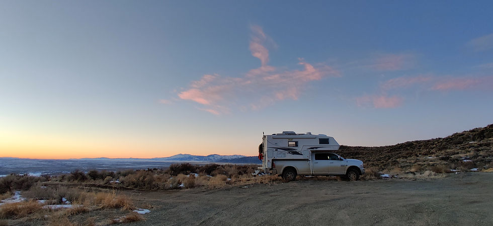
Made it to Magic Reservoir by the next day and found myself a spot on a ridge close to the edge that overlooked the the reservoir. This spot was right before the road dropped very sharply down to a sizable little community below me on the lakes edge. The reservoir was long and covered with ice and snow, with people ice fishing on it in a few spots. Luckily my ridge was pretty clear and melted of snow since it got plenty of sun. To the northwest towered a couple snow capped peaks, rounding out the reservoir as a pretty good spot for incredible sunsets and some cool clouds as well.
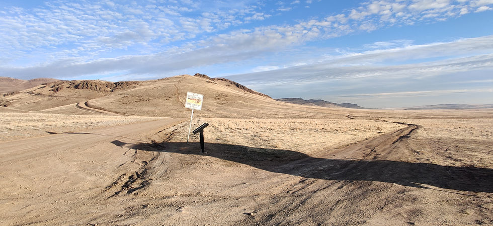
Now, I was nearing Atlanta, Idaho. Atlanta is a very well preserved ghost town but very remote. It would take me six hours to get there since I would have to drive three hours back towards Idaho City and then another three hours on a gravel road. I decided to bypass Atlanta and save it for a future trip, since everything there would likely be closed up anyways this time of year. Next I set my sights on driving the Oregon Trail scenic byway.
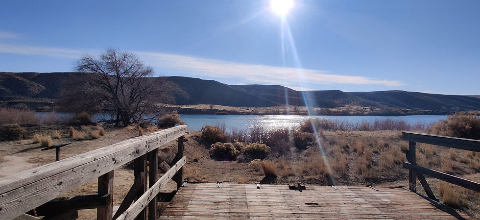
I started at Mountain Home and headed south towards Glenns Ferry. There at Three Island Crossing State Park while gazing across the Snake River, I could still see ruts in the hillside where all the wagons had dropped down. It was like they had been sliced into the hillside with a giant sword, scarring the slope for all time. But it made sense, tens of thousands if not hundreds of thousands of hardy settlers came over that slope by foot or wagon, leaving their mark. I now headed back up the byway, ready for 89 miles of mostly dirt with some history along the way.
That evening, I took a steep rough road up that hugged the side of the mountains pretty close. It was just off the byway and seemed like it might offer a good view of the sunset. At one turn, there was a hillside with a trail going up to the peak of a little mountain. I got out and walked up to be sure I could turn around without tipping the camper. Once I confirmed that the mountain top would be a suitable place to camp, I put the truck in first gear and and let it crawl up the hill. Once on top, I found my spot that was level enough to park and pointed the dinette window towards the setting sun. There, looking over the Boise River valley, I was humbled. The orange-red fading sun spread light so wide, I felt like I had never seen such an expansive valley before. In that moment the valley seemed vast and unknown, something that must have been intimidating to the first trappers there, even if it wasn't the treacherous ups and downs of mountains.
Hopped back on the byway the next day and one of the most interesting stops was Bowns Creek, a popular trail camping spot with its own "emigrant post office", aka a rock that settlers would write upon with axle grease or soot. The rock was large and maybe 20 feet long by 12 feet high, and I could indeed see faint dark letters in the rock. Not enough to make complete legible words out though, only a few letters. Unfortunately the rock was fenced off right along the roadside preventing a closer look. 170+ years later and I was able to still see the artwork of the some of the first outsiders into this area, hoping for a better life leaving reminders etched in time. Continuing on, I saw Bonneville Point near the end of the byway. It was a landmark on the trail and the spot from which Captain Bonneville stood in May of 1833 and his partner saw the river and exclaimed "Les bois les bois voyes les bois" which means "The woods, the woods, see the woods." That is how the city, river and valley got their name.
While not part of my planned route, Antelope Island, Magic reservoir, and the spots along the way were well worth it. The wandering that I have done across Utah and Idaho has provided some awesome views through cool terrain. Plus I love spur of the moment plans anyways and am happy to learn history anywhere I can, the further outta the way the spot is, all the better.
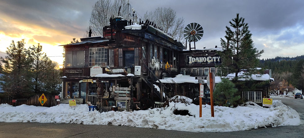
This house was one I found while walking the residential part of Idaho City. When I first saw it, I immediately thought of a pirate ship. The natural wood, thrown together appearance, the random building materials like fencing on top, and a large 30 pane window on the front, seemed like it could be something from Pirates of the Caribbean. The windows were stuffed with antiques, one can only imagine what the interior looks like, wish it had been open. The windmill and old lamp posts on the roof struck me as particularly unique!

The Idaho City Miners Exchange building, where miners of the Boise Basin gold rush would come for supplies.
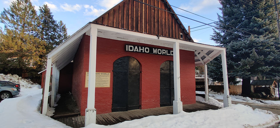
Former home of the Idaho World newspaper in Idaho City. The Idaho World is the oldest continuous newspaper in Idaho, founded in 1863. It occupied a handful of buildings in the city throughout its history.

This is the Magnolia Saloon, one of three original buildings still standing in Placerville, 15 miles and a mountain over from Idaho City. Gold was everywhere here, so much so that many buildings were built right over mining claims with a basement to allow mining to continue right under patrons feet! The saloon is now used as a museum. It has been said that gold is so abundant in Placerville that the streets are lined with gold, dust that is. Apparently in each handful of dry dirt one can see tiny flecks of gold. I tried this trick with the little mud and slush available and possibly saw a few, but I'm sure its much easier done with dry earth during the summer.

This is the Boise Basin Mercantile Company building in Placerville. There is another historical branch location preserved in Idaho City as well. The steel shutters on the front windows and door are for protection from fire. Those shutters and the buildings stone construction is why it has survived over the years when so many others burned. I particularly liked the old painted advertisement for the Owyhee Idaho Candy Co. Inside, the mercantile is setup like it must've been around the turn of the century; long counters with scales and shelves stocked with canned goods, clothing, and everything in between.
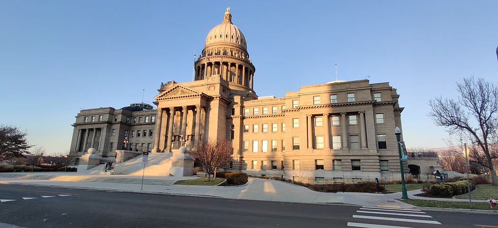
The Idaho State Capitol building in downtown Boise.
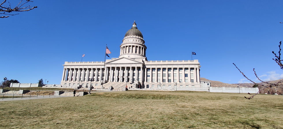
The Utah state capitol building in Salt Lake City. It sits upon a hill all its own and seems more at home in Washington D.C. than the west, because of its grand position standing alone on the hill and its lighter appearance even though the stone is Utah granite.
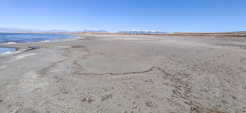
Wide open beaches of the Great Salt Lake on Antelope Island.
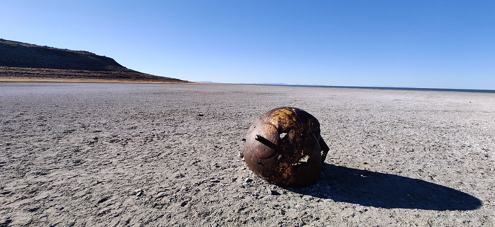
An old rusted out buoy of some sort, possibly leftover from the late 1980's when the lake was at its highest levels in recent history.
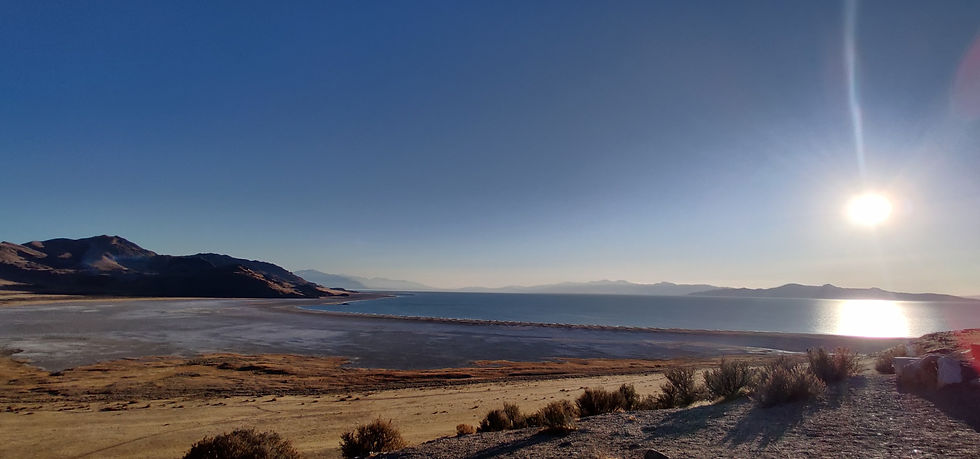
Photo taken from on top of Buffalo Point on Antelope Island overlooking White Rock Bay. Note the wide beach in the bay, the lake is at about its lowest point for the year around this time.
At Magic Reservoir with Moonstone Mountain in the background. The cloud looked like a ship to me.

Sunset with sweeping clouds over Magic Reservoir.

Sign near the spot where I joined up with the Main Oregon Trail Backcountry Byway.
The view from the spot where Glenns Ferry operated and then others up through the mid 20th century. Note the depression ahead in the river bank that brought the ferry to the waters edge. The beam of sun closest to the center of the photo crosses right through the original Oregon Trail cut into the hillside, you can see it if you look close. The Snake River in front of me was said to be one of the worst river crossings on the Oregon Trail, it is wider than it looks. Luckily there are three islands to my right and two to my left that were used for emigrants to cross before the ferry came in 1870.
The intersection of the Kelton Road, a popular freight road, with the trail. The Kelton road is the one going to the right, and intersected with the actual trail somewhere close in the distance in the same direction.
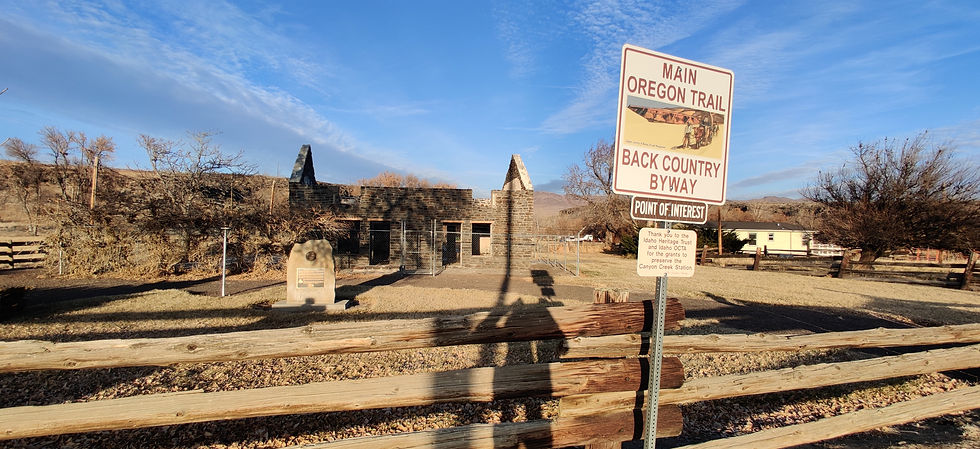
The stage stop at Canyon Creek. This creek was in a small valley that dropped maybe 40 feet down into the earth in the shape of a barrel. The stage stop is made of "lava rock with deer hair in the mortar" and was operated by Archibald and Harriette Daniel, who raised fruit and vegetables to feed the travelers.
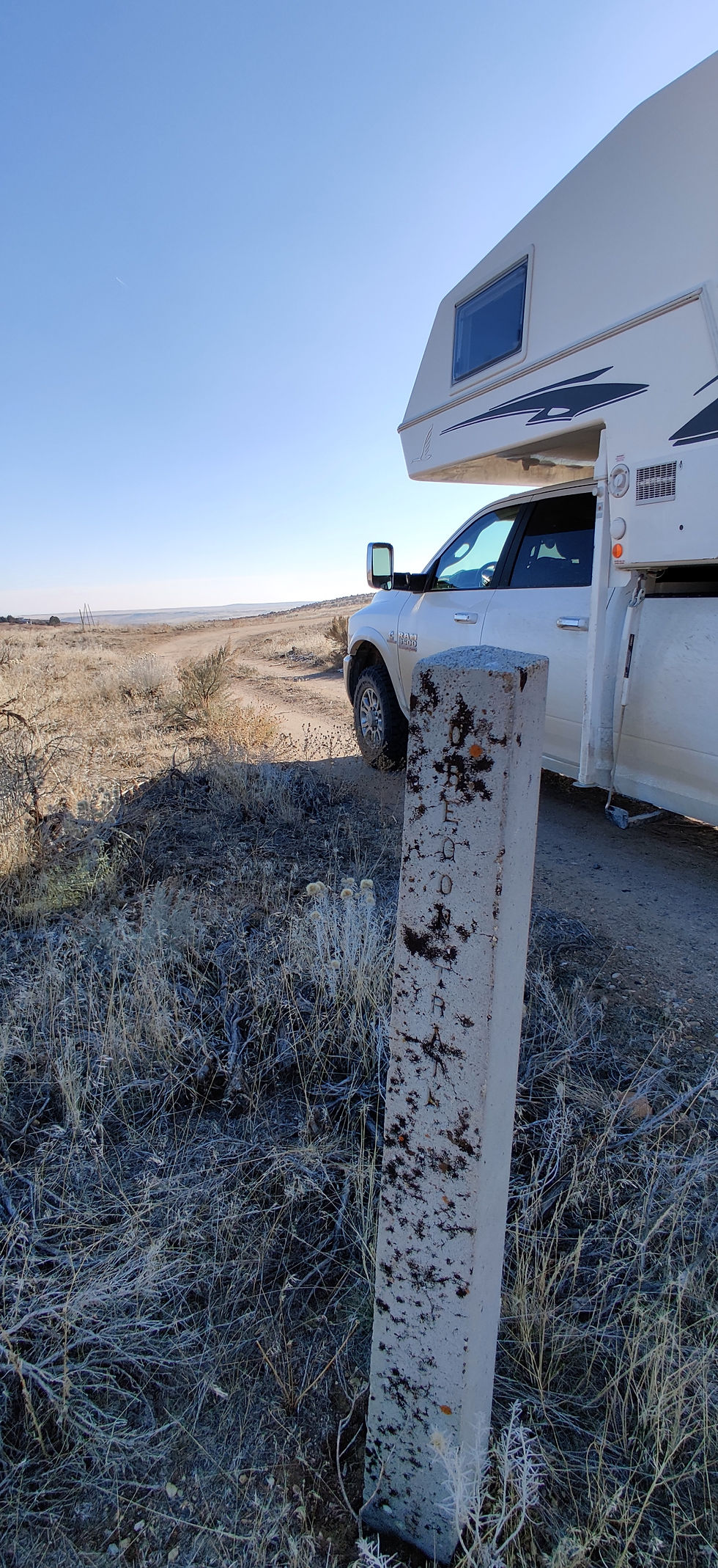
Oregon Trail marker near Bonneville Point.

Comments